How Do Solar Storms Affect GPS Accuracy?

How Do Solar Storms Affect GPS Accuracy?
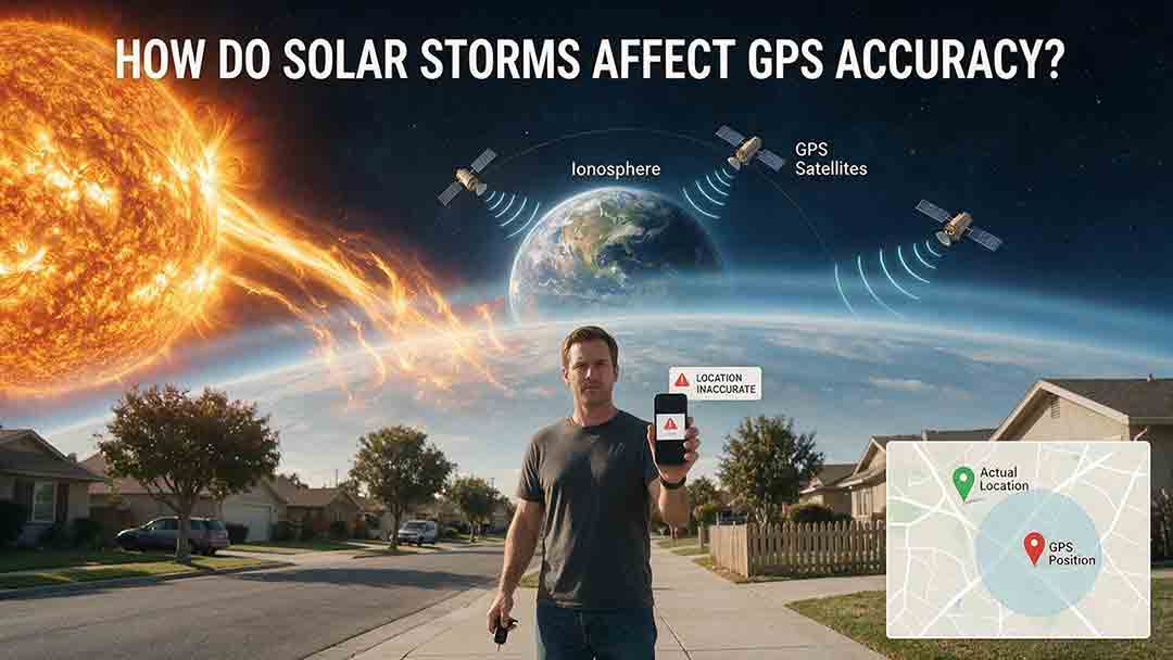
Solar storms can reduce GPS accuracy by disturbing the ionosphere, the electrically charged region that satellite signals cross before reaching a receiver. Rapid changes in electron density can add ranging errors, weaken correction models, interrupt carrier-phase tracking, or cause temporary loss of satellite lock. During severe disturbances, affected users may see errors of tens of meters or lose access to high-precision positioning services.
Key Takeaways
- Solar storms usually disturb the signal path through the ionosphere rather than shutting down the GPS constellation.
- Single-frequency receivers are more exposed to ionospheric delay. Dual-frequency equipment can remove most first-order delay but cannot prevent every scintillation or loss-of-lock event.
- Kp measures global geomagnetic activity; it does not predict a specific local GPS error.
- Phones, survey receivers, RTK systems, aviation augmentation services, and timing systems have different tolerances and failure modes.
- Important operations should combine official alerts with receiver diagnostics, service notices, known reference points, and an independent fallback.
GNSS is the collective term for global satellite-navigation constellations. GPS is the system operated by the United States; other major GNSS constellations include Europe’s Galileo, Russia’s GLONASS, and China’s BeiDou.
This article explains how solar activity becomes a navigation error, how large the effect can be, which systems are most vulnerable, and how to distinguish space-weather problems from obstruction, multipath, interference, mapping errors, correction outages, or damaged equipment.
The guidance applies to consumer navigation, agriculture, surveying, construction, drones, mapping, infrastructure timing, and other GPS-dependent work. It does not replace certified aviation, maritime, emergency-response, surveying, financial, telecommunications, or industrial procedures.
How Does a Solar Storm Turn Into a GPS Error?
A GPS receiver calculates position by measuring how long radio signals take to travel from several satellites.
Because GPS radio signals travel at approximately the speed of light in free space, a timing error of only a few billionths of a second can create a meaningful ranging error. The ionosphere changes that propagation time because it contains free electrons and acts as a dispersive medium.
A solar disturbance can affect a GPS solution through the following chain:
- The Sun releases enhanced radiation, energetic particles, or magnetized plasma.
- The disturbance changes conditions in Earth’s magnetosphere or ionosphere.
- Electron density becomes unusually high, low, uneven, or rapidly variable along one or more satellite-to-receiver paths.
- GNSS signals experience additional delay, phase variation, fading, refraction, or scattering.
- The receiver calculates a biased position, rejects measurements, loses a precision fix, or temporarily loses satellite lock.
The NOAA Space Weather Prediction Center explains that receivers normally compensate for an average or relatively quiet ionosphere. During disturbed conditions, the real ionosphere may change too quickly or become too irregular for those models to remain accurate.
Which Solar and Ionospheric Events Can Affect GPS?
“Solar storm” is a broad informal term. Different events produce different timing, geographical patterns, and navigation risks.
| Event | How it can affect GPS or GNSS | Most exposed region or period | Important limitation |
|---|---|---|---|
| Solar flare | X-ray and extreme-ultraviolet radiation can rapidly increase ionization and alter signal propagation | Sunlit side of Earth | Not every flare produces a noticeable position error |
| CME-driven geomagnetic storm | Energy entering the magnetosphere can redistribute ionospheric plasma and create large regional gradients | Often high latitudes first; strong storms may reach mid-latitudes | Effects can vary sharply across distance and time |
| Solar energetic particle event | Energetic particles can increase ionization in polar regions | Polar cap and high-latitude routes | Effects depend on particle intensity, equipment, and signal path |
| Storm-related scintillation | Small-scale plasma irregularities can produce rapid phase and signal-strength fluctuations | Auroral and other disturbed regions | Dual-frequency correction cannot guarantee continuous tracking |
| Natural equatorial scintillation | Post-sunset plasma instabilities scatter GNSS signals | Regions near the magnetic equator after sunset | It can occur without a geomagnetic storm |
A presentation archived by NASA’s Technical Reports Server reports solar-flare signatures in GNSS-derived total electron content and ionospheric-delay measurements. The NASA record identifies the source as a presentation associated with an American Geophysical Union meeting, not as a GPS operating standard.
Solar radiation reaches Earth in about eight minutes. The exact one-way light time changes slightly as Earth’s distance from the Sun varies; NASA gives an approximate Sun-to-Earth light time of 8.35 minutes.
A coronal mass ejection, or CME, travels much more slowly. A rapid flare-related response on the sunlit side can therefore occur well before a CME-driven geomagnetic storm reaches Earth.
Why Does the Ionosphere Change GPS Accuracy?
The ionosphere contains free electrons and ions. Its electron density changes with solar radiation, latitude, local time, season, geomagnetic activity, and atmospheric processes.
Two concepts are central to understanding GPS effects.
Total Electron Content, or TEC, is the number of free electrons integrated along a signal path between a satellite and a receiver. One TEC unit, or TECU, equals (10^{16}) electrons per square meter.
Ionospheric scintillation is a rapid fluctuation in a radio signal’s amplitude or phase caused by small-scale plasma irregularities.
A broad, smooth change in TEC mainly produces a frequency-dependent delay that can be estimated. Sharp gradients and rapidly changing irregularities are harder to manage because nearby receivers or signal paths may no longer experience nearly the same error.
How Is First-Order Ionospheric Delay Estimated?
The ESA-supported Navipedia technical reference on ionospheric delay gives the first-order group-delay relationship as:
$$
I=\frac{40.3\times \mathrm{STEC}}{f^2}
$$
where:
- (I) is the equivalent signal-path delay in meters;
- (\mathrm{STEC}) is slant total electron content in electrons per square meter;
- (f) is the signal frequency in hertz.
STEC is used because the equation applies to the total electron content along the actual slanted satellite-to-receiver path, not only to a vertical column above the receiver.
The official GPS Interface Specification IS-GPS-200N defines the nominal GPS L1 carrier frequency as 1575.42 MHz.
At that frequency, one TECU produces approximately 0.162 meters of first-order group delay along one signal path.
Illustrative First-Order GPS L1 Path Delays
These are calculated examples, not observed storm-error ranges.
| Slant TEC | Approximate first-order L1 path delay |
|---|---|
| 10 TECU | 1.62 m |
| 30 TECU | 4.87 m |
| 50 TECU | 8.12 m |
| 80 TECU | 12.99 m |
The values describe theoretical delay along one satellite-to-receiver path. They are not predictions of a receiver’s final horizontal or vertical position error.
A Worked Example
Assume the slant TEC along one signal path is 50 TECU:
$$
I_{L1}\frac{40.3\times50\times10^{16}}{\left(1.57542\times10^9\right)^2}\approx8.12\ \text{m}
$$
If disturbed conditions increase the slant TEC on the same path to 80 TECU:
$$
I_{L1}\approx12.99\ \text{m}
$$
The change in first-order path delay is:
$$
12.99-8.12=4.87\ \text{m}
$$
This does not mean the displayed position must move by exactly 4.87 meters.
A receiver combines measurements from several satellites. Its final solution also depends on:
- satellite geometry;
- measurements on other signal paths;
- receiver filtering;
- ionospheric correction models;
- antenna characteristics;
- multipath;
- satellite orbit and clock errors;
- augmentation or differential corrections;
- higher-order ionospheric effects.
The example is an educational calculation, not a forecast for a particular storm, location, receiver, or service.
Why Does Dual-Frequency GPS Usually Perform Better?
Ionospheric delay changes with frequency. A receiver observing two suitable frequencies can compare their delays and remove most of the first-order ionospheric term.
The GPS.gov accuracy guide explains that dual-frequency receivers can improve accuracy by correcting atmospheric signal distortion.
Dual-frequency processing does not guarantee protection from:
- rapid phase variation;
- amplitude fading;
- higher-order ionospheric residuals;
- cycle slips;
- weak signals;
- antenna problems;
- poor satellite geometry;
- loss of carrier-phase continuity;
- complete loss of lock.
A conference contribution archived by NASA’s Technical Reports Server examined ionospheric irregularities and scintillation using GNSS tracking networks. In the data and processing conditions studied, phase scintillation was associated with positioning errors more than an order of magnitude larger than the quieter comparison case. That result is specific to the analyzed data and should not be treated as a fixed multiplier for every storm or receiver.
How Large Can GPS Errors Become During a Solar Storm?
There is no universal “solar-storm GPS error.” The outcome depends on the storm, location, time, receiver, antenna, correction method, satellite geometry, signal environment, and the accuracy required by the task.
The NOAA Space Weather Prediction Center states that severe space-weather conditions can increase single-frequency GPS errors to tens of meters or more. NOAA also notes that a highly disturbed ionosphere can prevent a receiver from locking onto a satellite signal.
The GPS.gov accuracy guidance distinguishes GPS signal-in-space performance from the position a user actually obtains. Real user accuracy also depends on atmospheric conditions, receiver design, obstruction, multipath, interference, and satellite geometry.
| Operating condition | Possible effect on general navigation | Possible effect on precision positioning |
|---|---|---|
| Quiet ionosphere | Normal performance for the receiver and environment | Stable correction and carrier-phase tracking when other requirements are met |
| Mild disturbance | Small variation that many users may not notice | Noisier residuals, slower convergence, or occasional loss of a fixed solution |
| Strong regional disturbance | Inconsistent tracks or errors of several meters may appear | Cycle slips, correction mismatch, or failed ambiguity resolution |
| Severe ionospheric storm | Errors may reach tens of meters in affected situations | Precision or augmentation services may be withdrawn or become unusable |
| Strong scintillation | Position may jump, disappear, or require reacquisition | Loss of lock and interrupted carrier-phase continuity |
These are practical descriptions rather than guaranteed thresholds.
A low-cost receiver under trees or beside reflective buildings may perform worse on a quiet day than a professional multi-frequency receiver operating in open sky during a moderate disturbance.
Which GPS and GNSS Systems Are Most Vulnerable?
Receiver architecture changes the risk, but no satellite-navigation system is completely immune to the ionosphere.
| System | Main strength | Solar-storm limitation | Relative resilience |
|---|---|---|---|
| Single-frequency consumer receiver | Low cost and broad availability | Relies more heavily on a modeled ionospheric correction | Lowest |
| Dual-frequency consumer receiver | Removes most first-order ionospheric delay | May still suffer from scintillation, weak antennas, or loss of lock | Better |
| Multi-frequency, multi-constellation receiver | More signals improve redundancy and geometry | All GNSS signals still cross the ionosphere | Better, not immune |
| SBAS or WAAS receiver | Provides regional corrections and integrity information | A precision service may be withdrawn when safe error bounds cannot be guaranteed | High integrity, variable availability |
| RTK receiver | Can provide centimeter-level relative positioning | Base and rover errors may stop canceling across steep ionospheric gradients | High precision under suitable conditions |
| Network RTK receiver | Uses several reference stations to model regional errors | Regional models may struggle with fast, uneven ionospheric structure | Strong but model-dependent |
| PPP receiver | Does not require a nearby local base | Convergence may slow or restart after carrier-phase discontinuities | Strong when tracking remains stable |
| GPS-disciplined timing receiver | Provides precise timing for communications and infrastructure | Signal loss or delay uncertainty can force the system into holdover | Depends on clock and system design |
Why Can an RTK Fix Fail During a Storm?
RTK relies on continuous carrier-phase tracking and on the rover and reference station experiencing sufficiently similar errors.
That assumption becomes weaker when:
- the base-to-rover distance increases;
- ionospheric gradients become steep;
- the receiver loses lock;
- different satellite paths experience different disturbances;
- the correction link is delayed or interrupted.
Possible symptoms include fixed-to-float transitions, failed ambiguity resolution, cycle slips, unstable vertical coordinates, growing residuals, or disagreement with a known control point.
A displayed fixed solution should not be accepted solely because it contains many decimal places. Precision should be verified using control points, residuals, repeated observations, and the project’s acceptance criteria.
Where and When Are GPS Effects Most Likely?
High Latitudes During Geomagnetic Storms
Auroral and polar regions are often exposed to rapidly changing ionospheric structure during geomagnetic activity. Plasma motion and particle precipitation can produce steep TEC gradients and phase irregularities.
High-latitude operations may experience changing satellite usability, cycle slips, unstable carrier-phase measurements, or less reliable regional corrections. Major storms can expand these effects toward lower geomagnetic latitudes.
Mid-Latitudes During Strong Storms
Mid-latitude users normally face less extreme variability than polar users, but major storms can redistribute ionospheric plasma far beyond the usual auroral zone.
The operational concern is not simply an increase in electron content. A steep regional gradient can cause two receivers to experience different errors, weakening RTK, network RTK, or augmentation models.
Equatorial Regions After Sunset
Regions near the magnetic equator can experience strong post-sunset scintillation caused by natural plasma instabilities.
The NOAA Space Weather Prediction Center explains that these equatorial irregularities can be part of the ionosphere’s natural day-night cycle rather than the result of a space-weather storm.
A receiver losing lock near the equator after sunset should therefore not be treated as proof that a geomagnetic storm is responsible.
The Sunlit Hemisphere During a Solar Flare
Solar X-rays and extreme-ultraviolet radiation can change ionization rapidly on the sunlit side of Earth.
The navigation effect depends on flare intensity, solar position, local ionospheric conditions, receiver design, signal frequency, and satellite geometry. A flare creates a period of elevated risk; it does not guarantee a visible position shift in every receiver.
Does a High Kp Index Mean Local GPS Will Be Inaccurate?
No. Kp is a global three-hour index of geomagnetic activity. It does not directly measure TEC, scintillation, signal delay, or receiver error at a specific location.
The NOAA Space Weather Scales associate Kp values with broad possible effects:
| NOAA level | Kp | NOAA’s broad satellite-navigation description |
|---|---|---|
| G1 | 5 | No general satellite-navigation effect is listed |
| G2 | 6 | No general satellite-navigation effect is listed |
| G3 | 7 | Intermittent satellite-navigation problems may occur |
| G4 | 8, including 9-minus conditions | Satellite navigation may be degraded for hours |
| G5 | 9 | Satellite navigation may be degraded for days |
The absence of a navigation statement at G1 or G2 does not prove that every high-latitude or precision user will be unaffected. It means NOAA does not list a broad satellite-navigation effect for those geomagnetic levels.
Kp is useful as an alerting signal. A local decision should also consider regional TEC or scintillation information, geomagnetic latitude, local time, tracked satellites, correction age, carrier-phase continuity, service notices, and checks against known control.
What Did the May 2024 Storm Reveal About GPS Services?
The geomagnetic storm of May 10–12, 2024 provides a useful example because it shows the difference between GPS signals continuing to exist and a precision service remaining safe to use.
According to the FAA WAAS event report:
- LP, LPV, and LPV-200 WAAS services were lost in the contiguous United States and Alaska during parts of the event;
- WAAS non-precision approach coverage at the stated RNP levels was not affected in the same way;
- the WAAS Extreme Storm Detector entered its protective state;
- vertical service was disabled because the disturbed ionosphere could not be bounded normally.
The FAA table lists 1,921 airports in the contiguous United States with published LPV approaches as experiencing an LPV outage of at least 15 minutes during the report’s May 10–11 analysis window.
That number does not mean every form of GPS navigation failed at those airports. It refers specifically to airports with published LPV approaches that experienced an LPV service outage in the FAA analysis.
The GPS constellation continued broadcasting. WAAS withdrew particular service levels because it could not guarantee the required protection bounds.
Accuracy, Integrity, Availability, and Continuity Are Different
The GPS Standard Positioning Service Performance Standard treats accuracy, integrity, availability, and continuity as separate performance attributes.
The following descriptions are simplified practical meanings, not complete regulatory definitions.
| Term | Practical meaning |
|---|---|
| Accuracy | How close the calculated position or time is to the true value |
| Integrity | Whether the system can provide a timely warning when performance should not be trusted |
| Availability | Whether the required service level is being provided |
| Continuity | Whether the service is likely to continue without an unscheduled interruption during an operation |
A high-integrity system may intentionally stop offering a precision service instead of continuing with an error bound it cannot guarantee.
For certified operations, use the definitions, thresholds, probabilities, service volumes, and alerting requirements in the applicable performance standard.
How to Judge GPS Risk for a Specific Task
A useful four-layer check considers the event, location, receiver architecture, and acceptable error. This framework was developed for this article by organizing established GNSS and space-weather principles into a practical decision process. It is not an official forecast model.
| Layer | Question | Evidence to check | Decision it supports |
|---|---|---|---|
| Event | What type of disturbance is occurring? | NOAA flare, radio-blackout, radiation-storm, and geomagnetic-storm products | Identify the likely mechanism and timing |
| Location and time | Where and when will the receiver operate? | Geomagnetic latitude, daylight, local time, and regional monitoring | Estimate geographical exposure |
| Receiver and service | What positioning architecture is being used? | Frequencies, constellations, correction method, antenna, firmware, and service notices | Estimate technical resilience |
| Error tolerance | How much error can the task accept? | Project limits, known control, integrity requirements, and backup methods | Continue, verify, downgrade, postpone, or stop |
The same disturbance may be irrelevant to a recreational map user but unacceptable for survey control, centimeter-level construction, aviation vertical guidance, communications synchronization, or GPS-dependent timing in parts of an electrical power system.
A 30-Second GPS Anomaly Check
When GPS performance changes unexpectedly, ask:
- Is there an official space-weather, GPS, augmentation, or correction-service alert?
- Are several independent receivers or users affected across the same region?
- Did satellite tracking, signal quality, correction age, ambiguity status, or carrier-phase continuity change?
- Does the receiver disagree with a known reference or independent positioning method?
- Is the observed instability large enough to exceed the task’s error limit?
When the first three answers are no, obstruction, multipath, an antenna fault, mapping data, local interference, receiver configuration, or a correction-link failure may be more likely than a solar storm.
This process is a triage tool. It cannot prove the cause of a particular incident.
What Should GPS Users Do Before a Forecast Storm?
Begin by defining what the task requires. Approximate recreational location, ordinary road navigation, sub-meter mapping, centimeter-level construction, certified navigation integrity, and uninterrupted timing are not equivalent use cases.
Then check the event type rather than relying only on a headline storm level. Official information from the NOAA Space Weather Prediction Center can help distinguish a solar flare, radio blackout, solar radiation storm, and CME-driven geomagnetic storm.
A space-weather alert alone does not prove that a receiver problem is storm-related. Also check:
- GPS constellation status;
- WAAS or another SBAS service status;
- RTK or network RTK availability;
- correction subscriptions and data links;
- receiver firmware;
- antenna mounting and cable condition;
- local radio-interference reports;
- device power and configuration.
The U.S. Coast Guard Navigation Center provides links to GPS and space-weather status information for U.S. users.
Before conditions deteriorate, record normal performance at the work site. Useful baseline measurements include tracked satellites, signal-quality indicators, position dilution of precision, correction age, RTK status, PPP convergence time, coordinates at a known point, and timing holdover status.
A backup should not depend on the same signals, antenna environment, correction network, or data connection as the primary system. Depending on the application, it may include offline maps, known landmarks, inertial navigation, surveyed control, conventional surveying methods, a stable local oscillator, another correction source, or postponement of nonessential precision work.
Finally, establish a rejection or stop-work threshold before the operation begins. Possible triggers include repeated RTK fixed-to-float transitions, residuals outside the project limit, disagreement with control, repeated cycle slips, excessive correction age, loss of a required integrity service, or timing holdover beyond the system’s qualified duration.
How Can Solar Storms Affect GPS Timing?
A receiver can experience a timing problem even when its displayed position does not look obviously wrong.
GPS timing supports telecommunications networks, data centers, broadcast systems, scientific observatories, industrial control systems, financial timestamping, and timing or synchronization in parts of electrical power systems.
Free electrons in the ionosphere delay the arrival of a GPS signal. A conference paper archived by NASA’s Technical Reports Server discusses ionospheric corrections in precise GPS time transfer and the use of dual-frequency observations to estimate the relevant correction.
A propagation error does not necessarily mean the local clock immediately acquires an equal error. The outcome depends on receiver filtering, multi-frequency correction, the number of usable signals, alarm logic, oscillator quality, and holdover design.
Holdover is the period during which a local oscillator attempts to maintain time after reliable satellite tracking is lost.
Timing-system operators should know:
- whether the receiver has entered holdover;
- what type of local oscillator it uses;
- how long the oscillator can maintain the required performance;
- whether an independent timing source is available;
- whether alarms distinguish antenna failure, signal loss, and excessive time error;
- how the system returns from holdover;
- whether reacquisition can produce a time step;
- what the manufacturer specifies for the intended environment.
No single holdover time or acceptable offset applies to every system.
Financial, communications, power, and industrial operators should follow the timing accuracy, traceability, redundancy, audit, and recovery requirements applicable to their jurisdiction and service.
How Can You Troubleshoot Sudden GPS Errors?
| Symptom | Possible ionospheric explanation | Other causes to check | Practical response |
|---|---|---|---|
| Position drifts gradually | Changing TEC or correction-model mismatch | Tree cover, multipath, weak geometry | Move to open sky and compare with a known point |
| Position jumps suddenly | Signal loss and reacquisition during scintillation | Interference, spoofing, antenna fault, urban reflections | Compare independent systems and stop safety-critical use |
| RTK changes from fixed to float | Cycle slips or spatial ionospheric gradients | Correction-link failure, long baseline, poor satellite overlap | Check residuals, correction age, common satellites, and control |
| PPP repeatedly reconverges | Loss of carrier-phase continuity | Receiver reset or data interruption | Preserve logs and postpone critical collection if necessary |
| WAAS precision mode disappears | Protective integrity response to ionospheric uncertainty | GEO obstruction or receiver configuration | Check official service status and use only an approved available mode |
| Navigation marker appears on the wrong road | Usually not a direct solar-storm signature | Incorrect map data or geocoding | Compare raw coordinates with another map |
| Only one receiver fails | A storm remains possible but is less likely as the sole cause | Cable, antenna, firmware, power, or hardware fault | Test independent equipment and inspect the installation |
| Many users fail across one region | Regional ionospheric disturbance is possible | Regional jamming or correction-network outage | Check official space-weather, GNSS, and interference reports |
| Timing equipment enters holdover | Loss of usable tracking or excessive delay uncertainty | Antenna fault, cable damage, interference, receiver reset | Check alarms, independent time, oscillator status, and manufacturer procedures |
Spoofing is the transmission of counterfeit navigation signals intended to mislead a receiver. It can resemble some GPS anomalies, but it is a separate interference problem and should not be diagnosed solely from an unusual position display.
Space weather should be treated as one diagnostic possibility, not the default explanation for every GPS anomaly.
Which Mistakes Most Often Lead to Bad Decisions?
Do not treat Kp as a meter-error forecast. It is a global activity index, not a local accuracy measurement.
Do not confuse precision with accuracy. A receiver can display stable coordinates with many decimal places while remaining biased.
Do not interpret service withdrawal as satellite failure. An augmentation system may remove a precision service because it cannot safely bound the error, while the underlying signals remain available for less demanding uses.
Do not blame the Sun before checking the installation. Loose connectors, damaged antennas, poor ground planes, obstruction, nearby transmitters, outdated firmware, and interrupted corrections are often more plausible when only one device is affected.
More satellites and frequencies improve resilience, but they do not remove the ionosphere from the signal path.
GPS Solar-Storm Readiness Checklist
Before important GPS or GNSS work:
- Define the maximum acceptable horizontal, vertical, and timing error.
- Confirm whether the receiver is single-frequency, dual-frequency, or multi-frequency.
- Identify the correction architecture: standalone, SBAS, RTK, network RTK, or PPP.
- Check official space-weather and navigation-service information.
- Record normal performance at a known reference point.
- Verify the antenna, cable, power, firmware, and data connection.
- Confirm a genuinely independent fallback method.
- Establish data-rejection and stop-work thresholds.
- Save raw observations and diagnostic logs when possible.
- Reobserve critical points after conditions stabilize.
- Document lost lock, degraded corrections, or service withdrawal.
- Confirm timing holdover and recovery behavior where timing matters.
- Follow certified procedures for safety-critical operations.
Limits of This Guide
This article does not claim that every solar flare or geomagnetic storm produces a noticeable GPS error at every location.
It also does not claim that every position jump, lost RTK fix, navigation outage, or timing alarm is caused by solar activity.
Similar symptoms can result from signal obstruction, multipath, poor satellite geometry, radio interference, spoofing, damaged antennas, receiver faults, mapping errors, correction-network failures, software problems, or incorrect configuration.
Determining the cause of a specific incident may require raw receiver observations, regional ionospheric measurements, network records, spectrum monitoring, official service notices, and equipment inspection.
This guide is based on published specifications, official agency material, institutional technical references, standard propagation equations, and practical diagnostic criteria rather than hands-on testing of individual receivers.
Conclusion
Solar storms affect GPS accuracy mainly by making the ionosphere more difficult to measure and model.
Smooth ionospheric delay can often be reduced with dual-frequency processing. Rapid gradients and scintillation can still destabilize corrections, interrupt carrier-phase tracking, remove augmentation services, affect timing, or cause signal loss.
For ordinary navigation, keep an offline map and compare implausible positions with the surrounding environment.
For surveying, construction, agriculture, drones, mapping, and timing systems, monitor solution-quality indicators, check known references, preserve logs, apply predefined acceptance limits, and maintain an independent fallback.
For aviation, maritime, emergency, financial, and other regulated or safety-critical operations, follow applicable service notices, standards, manufacturer instructions, and approved fallback procedures.
A receiver continuing to display a position or time does not prove that the required accuracy, integrity, availability, or continuity is still being delivered.
Frequently Asked Questions
Can solar storms affect GPS timing without creating an obvious position error?
Yes. A timing receiver may experience increased propagation uncertainty, loss of tracked satellites, or a transition into holdover without displaying a dramatic position jump. The actual clock effect depends on receiver processing, available frequencies, oscillator quality, alarm logic, and system design.
Will restarting a phone or GPS receiver fix a space-weather-related problem?
Restarting may correct a local software or receiver-state problem, but it cannot remove a disturbed ionosphere. A restart may temporarily improve acquisition while the same propagation conditions continue to affect the signals.
Can a solar storm physically damage a GPS receiver?
The ionospheric propagation effects discussed here normally degrade signals rather than physically damage a ground receiver. Space weather can affect satellites and other infrastructure through separate mechanisms, but a navigation error alone is not evidence of receiver damage.
Do Galileo, BeiDou, and GLONASS avoid the same ionospheric problem?
No. Their signals and frequencies differ, but their radio waves still cross Earth’s ionosphere. Multi-constellation equipment can improve geometry and redundancy without eliminating the propagation environment.
Where can users check current GPS and space-weather status?
U.S. users can check the NOAA Space Weather Prediction Center, the U.S. Coast Guard Navigation Center, GPS service notices, and the official status page for the correction or augmentation service they use.
Can GPS problems continue after Kp begins to fall?
Yes. Kp is a global three-hour index and does not describe every local ionospheric structure. Regional gradients, scintillation, receiver reacquisition, correction-system recovery, or PPP reconvergence may continue after the headline geomagnetic level declines.
Sources
- NOAA Space Weather Prediction Center — Space Weather and GPS Systems. Accessed August 3, 2026.
- NOAA Space Weather Prediction Center — NOAA Space Weather Scales. Accessed August 3, 2026.
- GPS.gov — GPS Accuracy. Accessed August 3, 2026.
- GPS.gov — GPS Standard Positioning Service Performance Standard, Fifth Edition. Published April 2020.
- GPS.gov — IS-GPS-200N: NAVSTAR GPS Space Segment/Navigation User Segment Interfaces. Revision N, August 2022.
- GPS.gov — IRN-IS-200N-003. Interface Revision Notice dated September 27, 2023.
- ESA-supported Navipedia — Ionospheric Delay. Technical reference.
- Federal Aviation Administration — DR 158: Ionospheric Activity, May 10–12, 2024. Published May 15, 2024.
- NASA Technical Reports Server — Survey of Localized Solar Flare Signatures in the Ionosphere With GNSS, VLF, and GOES Observations. Document type: Presentation; published December 10, 2018.
- NASA Technical Reports Server — Observations of Global and Regional Ionospheric Irregularities and Scintillation Using GNSS Tracking Networks. Conference contribution; published April 22, 2013.
- NASA — Facts About Earth. Accessed August 3, 2026.
- NASA Technical Reports Server — Ionospheric Corrections to Precise Time Transfer Using GPS. Conference paper published in 1993.
- U.S. Coast Guard Navigation Center — Space Weather Information and Ephemeris Data. Accessed August 3, 2026.
Research and Review Notes
This article was checked against official government, space-agency, interface-specification, and institutional technical-reference materials from NOAA, GPS.gov, the FAA, NASA, ESA-supported Navipedia, and the U.S. Coast Guard.
The L1 delay examples were recalculated during editorial review from the stated first-order ionospheric-delay equation, official 1575.42 MHz L1 frequency, units, and TEC values.
The GPS L1 parameter used in the calculation comes from IS-GPS-200N. GPS.gov also publishes IRN-IS-200N-003 as an active revision notice; the revision notice does not change the L1 frequency used in this example. Proposed change notices are not presented here as fully issued replacement specifications.
The FAA airport count, event dates, service distinctions, and the practical separation of accuracy, integrity, availability, and continuity were reviewed against the cited materials.
NASA Technical Reports Server records are described according to their available document metadata and are not presented as GPS operating standards. No independent receiver field test, professional certification, or unnamed external technical reviewer is claimed.
More from Technology & Infrastructure Impacts
Can Solar Storms Damage Phones, Cars, or Home Electronics?
Solar storms are unlikely to directly destroy phones, disable passenger cars, or fry unplugged home electronics at ground level. The more realistic risks are indirect: degraded GPS accuracy, interrupted satellite or cellular services, power-grid disturbances, unavailable EV chargers, fuel-pump outages, and ordinary electrical problems during power restoration. This article explains why long, grounded infrastructure is more vulnerable to geomagnetically induced currents than compact consumer devices. It also separates solar flares, radiation storms, coronal mass ejections, and geomagnetic storms so readers can understand which technology effects belong to each event. Using the original Scale–Path–Dependency–Recovery framework, risk matrices, a May 2024 storm case study, troubleshooting guidance, and user-specific preparation advice, the guide helps households evaluate realistic exposure without fear-based claims. It also covers surge-protection limits, medical-equipment planning, offline navigation, EV charging, and safe outage preparation based on authoritative NOAA, NASA, USGS, NIST, Department of Energy, and Ready.gov guidance.
Can a Geomagnetic Storm Disrupt the Power Grid?
A geomagnetic storm can disrupt the power grid by creating geoelectric fields that drive geomagnetically induced currents through long, grounded transmission networks. This article explains how those currents can push transformers into part-cycle saturation, increase reactive-power demand, produce harmonics, trigger protective equipment, and—under severe conditions—contribute to voltage instability or a regional blackout. It also shows why a NOAA G5 rating does not automatically predict a local power failure. Using an original Four-Gate Grid Disruption Framework, a simplified voltage calculation, and a balanced comparison of the March 1989 Québec blackout and the May 2024 Gannon Storm, the guide examines how geology, line orientation, transformer design, system loading, and operator preparation shape the outcome. Readers will also find practical outage-preparation guidance for households, medical-device users, businesses, solar-and-battery owners, and critical facilities, supported by authoritative NOAA, USGS, NERC, DOE, Hydro-Québec, and Ready.gov sources.
How Does Space Weather Affect Radio Communication?
Space weather can disrupt radio communication by changing the ionosphere, the electrically charged region used by long-distance HF radio and crossed by satellite signals. This article explains how solar flares can cause almost immediate HF radio blackouts on Earth’s sunlit side, how energetic particles can weaken polar communication routes, and how geomagnetic storms can alter usable frequencies and propagation paths. It also examines ionospheric scintillation, satellite signal fading, GNSS errors, and solar radio noise. Readers will learn how to distinguish space-weather effects from antenna faults, local interference, power problems, and network outages. The article introduces the EPBS Radio Impact Check—Event, Path, Band, and Symptom—as a practical diagnostic framework, supported by a documented NOAA R3 event, a link-margin calculation, troubleshooting tables, and mitigation options. It emphasizes that forecasts describe environmental conditions rather than guaranteeing failure on any individual radio link.
Explore More Topics
How to Photograph the Northern Lights
Photographing the Northern Lights requires more than choosing one fixed camera setting. This practical guide explains how to select a camera and lens, focus accurately on stars, stabilize your equipment, and adjust shutter speed, aperture, and ISO according to the aurora’s brightness and movement. It includes starting settings for fast, moderate, and faint displays, along with a Motion–Brightness–Foreground framework that helps photographers make better decisions as conditions change. Readers will also learn how to use a smartphone Night mode, compose a stronger foreground, protect color-channel highlights, edit images responsibly, and disclose exposure blends clearly. A quick-reference card, three-frame comparison method, packing checklist, safety guidance, and detailed troubleshooting table make the article useful in the field. The guide relies on published guidance from NASA, NOAA, Nikon, Canon, and Apple while clearly distinguishing authoritative information from adjustable photography recommendations.
How Far South Can the Northern Lights Be Seen?
The northern lights usually remain within high-latitude regions, but powerful geomagnetic storms can carry visible aurora surprisingly far south. This guide explains why there is no single worldwide southern boundary and shows how geomagnetic latitude, the auroral oval, Kp, storm intensity, emission altitude, darkness, cloud cover, and local light pollution affect what an observer may see. It examines NOAA’s generalized U.S. visibility examples for G1 through G5 storms, while clarifying that locations such as Alabama, Florida, and southern Texas represent rare historical possibilities rather than guaranteed forecast limits. Readers will also find an original four-gate decision framework, an auditable geometric viewing-distance example, regional viewing guidance, a practical checklist, and troubleshooting advice for distinguishing faint aurora from clouds or artificial sky glow. The article helps observers decide when a forecast justifies going outside or traveling to a safer, darker viewing site.
What Are the Best Conditions for Seeing the Northern Lights?
The best Northern Lights viewing conditions occur when geomagnetic activity, clear weather, darkness, and a suitable observing location align. This guide explains why the position of the auroral oval matters more than relying on a single Kp value and shows how cloud cover, twilight, light pollution, moonlight, atmospheric transparency, and horizon visibility affect what an observer can see. It introduces the Five-Gate Aurora Viewing Framework, a practical planning tool that evaluates aurora activity, clouds, darkness, location, and available viewing time without presenting the result as a guaranteed probability. Readers will also learn how to compare short- and long-range forecasts, convert UTC forecast periods, choose a safe dark-sky site, recognize faint aurora, and troubleshoot a promising forecast that produces no visible display. The article is based on guidance from NOAA, NASA, the University of Alaska Fairbanks, and the National Park Service.