How to Set Up Alerts for Solar Storms and Aurora Activity

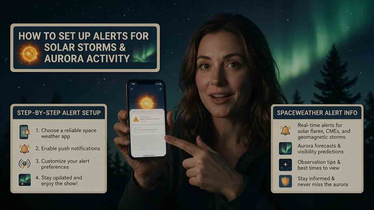
How to Set Up Alerts for Solar Storms and Aurora Activity
The most reliable way to receive solar storm and aurora alerts is to combine official NOAA Space Weather Prediction Center messages with one location-aware aurora tool and a local cloud forecast. Use watches for advance planning, warnings for near-term preparation, and observed-threshold alerts for immediate checks. Before traveling, confirm the auroral oval, darkness, clouds, access, and road conditions.
Key Takeaways
- Use the NOAA Space Weather Prediction Center Product Subscription Service as the authoritative foundation for email alerts.
- Aurora observers should prioritize geomagnetic products instead of subscribing to every solar flare, radio-burst, or radiation message.
- A watch, warning, and alert do not mean the same thing, and NOAA uses several more specific product names within those categories.
- Personal Kp thresholds and official NOAA G-level watches are different notification types, not interchangeable measurements.
- No alert can guarantee visible aurora because darkness, clouds, oval position, light pollution, horizon quality, and storm timing still matter.
This guide explains how to choose useful products, turn NOAA emails into phone notifications, set location-appropriate thresholds, verify an alert before traveling, and test whether the entire notification chain is working.
Who Is This Alert System For?
This setup is designed for people who want to:
- Observe or photograph the northern or southern lights
- Receive advance notice of possible geomagnetic storms
- Follow important space-weather activity without watching a dashboard continuously
- Decide whether an aurora-viewing trip is worth considering
- Monitor conditions relevant to amateur radio, navigation, satellites, aviation, or infrastructure awareness
Aurora observers and technical operators should not use identical settings.
A casual observer mainly needs geomagnetic activity, auroral position, darkness, and cloud information. A radio operator may also need radio-blackout products. An aviation, satellite, power-grid, or navigation organization should use documented operational procedures rather than a recreational alert configuration.
This guide is based on published specifications, authoritative documentation, and practical selection criteria rather than hands-on product testing. It does not claim that any app, email provider, or notification method has been independently tested unless a dated test record is shown.
Which Solar Storm Alerts Matter Most for Aurora Viewing?
For most aurora observers, geomagnetic forecasts, watches, warnings, and alerts are the most useful products.
Geomagnetic disturbances can expand and intensify the auroral oval, increasing the possibility of aurora farther from the magnetic poles. Solar flares, radio blackouts, and solar radiation storms are related forms of space weather, but their notifications do not automatically mean that visible aurora will occur.
| Product or data type | Common scale or measurement | Main purpose | Value for aurora observers |
|---|---|---|---|
| Geomagnetic activity | NOAA G1–G5 scale and planetary Kp | Describes disturbances in Earth’s magnetic environment | Primary alert category |
| Radio blackout | NOAA R1–R5 scale | Describes flare-related effects on HF radio and some navigation signals | Usually secondary for aurora planning |
| Solar radiation storm | NOAA S1–S5 scale | Describes elevated energetic-particle conditions | Limited value for casual viewing |
| Aurora forecast | OVATION model output | Estimates auroral location and intensity | Important for short-term geographic checks |
| Local weather | Clouds, precipitation, haze, visibility, and wind | Describes conditions at the viewing site | Essential for the final decision |
| Darkness information | Sunset, twilight, and moonlight | Shows whether a faint display may be visible | Essential for actual observation |
A solar flare can cause a radio blackout on the sunlit side of Earth. It may also be associated with a coronal mass ejection, but the flare alert alone does not confirm that an Earth-directed disturbance will arrive or produce a geomagnetic storm.
For aurora planning, begin with geomagnetic products. Add R-scale or S-scale notifications only when they support a separate technical purpose.
How Do NOAA Watches, Warnings, Alerts, and Forecasts Differ?
A practical simplified interpretation is:
- A watch means storm-level conditions are possible during a future period.
- A warning means a defined condition is expected during a stated near-term period.
- An alert reports that a measured threshold has been reached.
- A forecast provides a scheduled outlook whether or not a specific event message is active.
| Message type | What it usually tells you | Best response for an aurora observer |
|---|---|---|
| Watch | Storm conditions may develop during the forecast period | Review timing, weather, access, and equipment |
| Warning | A specified threshold is expected within a stated validity period | Prepare and monitor current data more closely |
| Alert | A measured threshold has been reached | Check the latest aurora map and local sky |
| Forecast | Expected conditions over a scheduled outlook period | Maintain routine awareness and plan ahead |
According to NOAA’s Subscription Services documentation, a geomagnetic storm watch can cover the current day through the third forecast day, providing up to roughly 72 hours of planning time. The exact timing and strength remain uncertain because the magnetic structure of an approaching solar-wind disturbance cannot be known precisely far in advance.
Why Should You Read the Full NOAA Product Name?
NOAA’s actual product catalog is more specific than the four-part summary above.
It includes products such as:
- Geomagnetic storm watches by expected G category
- Geomagnetic K-index warnings at defined thresholds
- Geomagnetic K-index alerts after thresholds are observed
- A geomagnetic storm warning for stronger expected storming
- Geomagnetic sudden-impulse expected warnings
- Scheduled forecasts and forecast discussions
- Post-event summaries
A K-index warning and a sudden-impulse expected warning do not describe the same condition. The word “warning” alone is not enough to determine what action is appropriate.
Whenever a message arrives, read:
- The complete product title
- The issue time
- The valid-from and valid-until times
- The Kp threshold or NOAA scale level
- Whether the message is new, extended, upgraded, or canceled
- Any forecaster comments included in the message
How Do You Set Up Solar Storm and Aurora Alerts?
A dependable system separates three jobs:
- Official messages provide advance notice and confirmation.
- An aurora forecast shows where activity may be concentrated.
- Local weather and darkness determine whether observation is practical.
One application rarely handles all three jobs equally well.
Step 1: Decide What You Want the Alert to Trigger
Before subscribing, define the action you expect to take.
Possible actions include:
- Check whether the next night may offer an aurora opportunity
- Charge camera batteries and prepare cold-weather equipment
- Decide whether to stay awake for a later update
- Recheck clouds before driving
- Review possible HF radio or GNSS effects
- Notify an operations team to consult an approved dashboard
An alert should support a decision. If a notification never changes what you do, it probably does not need to produce a sound or appear on the lock screen.
Step 2: Register for NOAA Email Products
The NOAA Space Weather Prediction Center Product Subscription Service distributes forecasts, watches, warnings, alerts, and summaries by email.
The basic setup process is:
- Open the official Product Subscription Service.
- Register with your name and email address.
- Open the verification email.
- Follow the verification link to activate the account.
- Sign in and select the products relevant to your purpose.
- Review the selected products before saving.
- Check the spam or junk folder after the first messages are issued.
The page layout, product grouping, and button names may change. Follow the current official interface rather than relying on old screenshots or exact button positions from another tutorial.
Step 3: Begin With a Small Product Set
A practical starting set for an aurora observer is:
- The NOAA 3-Day Forecast
- Geomagnetic storm watches at an appropriate G level
- Geomagnetic K-index warnings at a chosen threshold
- Geomagnetic K-index alerts at the same or a slightly higher threshold
The NOAA 3-Day Forecast provides scheduled outlook information for geomagnetic activity, radio blackouts, and solar radiation storms. It is useful for planning but should not be treated as a promise that a storm will begin or peak at one exact local hour.
Post-event summaries, radio-emission products, particle-flux messages, and other specialist products may be valuable for research or technical operations. They can create unnecessary alert fatigue for someone whose only purpose is aurora viewing.
Step 4: Choose Thresholds That Fit Your Location
There is no universal Kp threshold that guarantees visible aurora.
A useful threshold depends on:
- Geomagnetic latitude
- Auroral oval position
- Whether the display is overhead or low on the horizon
- Local darkness
- Clouds, haze, and smoke
- Light pollution
- Terrain and horizon obstructions
- Storm duration and short-term variation
Geomagnetic latitude is more relevant than ordinary geographic latitude. Two cities at similar geographic latitudes can have different aurora opportunities because Earth’s magnetic and geographic poles do not coincide.
Personal Kp thresholds and NOAA G-level watches are different notification types. The following entries are suggested planning combinations, not mathematical equivalents.
| Observer situation | Planning notification | Escalation notification | Why it may be useful |
|---|---|---|---|
| Frequent-aurora region | Personal Kp 4 notification or official G1 watch | Kp 4–5 warning or alert | Moderate activity may already be worth checking |
| Northern or southern mid-latitudes | G1–G2 watch | Kp 5–6 warning or alert | Reduces routine high-latitude notifications |
| Lower mid-latitudes | G2–G3 watch | Kp 6–7 warning or alert | Focuses on less frequent expansion |
| Aurora traveler | Relevant watches during travel dates | Current oval and local-weather confirmation | Provides planning time without promising a display |
| Amateur radio user | Relevant G- and R-scale products | Thresholds tied to operating needs | Aurora visibility is not the only concern |
| Operational organization | Organization-defined criteria | Approved escalation procedure | Recreational thresholds are insufficient |
The NOAA Space Weather Scales associate the following geomagnetic levels with planetary Kp:
| NOAA geomagnetic level | Planetary Kp |
|---|---|
| G1 — Minor | Kp 5 |
| G2 — Moderate | Kp 6 |
| G3 — Strong | Kp 7 |
| G4 — Severe | Kp 8, including 9− |
| G5 — Extreme | Kp 9 |
These categories describe broad geomagnetic storm severity and possible effects. They do not predict visibility from one city, road, or backyard.
Start with a conservative setting. After several active periods, adjust it based on whether the notifications helped you make better decisions.
Step 5: Turn Important Emails Into Phone Notifications
An email subscription becomes more useful when selected messages can reach the phone promptly.
A platform-independent setup is:
- Add the NOAA sender or domain to your approved contacts.
- Create a mail rule for the products that matter to you.
- Apply a dedicated folder or label such as
Space Weather. - Enable notifications for that sender, folder, or label.
- Keep routine planning messages silent if they do not require action.
- Reserve sound or lock-screen alerts for escalation thresholds.
- Confirm that background mail synchronization is active.
- Review battery-saving, focus, sleep, and do-not-disturb settings.
Possible filter terms include:
- Geomagnetic Storm Watch
- Geomagnetic K-index
- WARNING
- ALERT
- G2
- G3
Do not filter only for a broad word such as storm. It may appear in forecasts, summaries, or explanatory text that does not require an immediate response.
After the first few NOAA messages arrive, compare the actual subject lines with your mail rule. Product wording and formatting may change, so a filter should be tested rather than assumed to match indefinitely.
Email delivery can be affected by the sending system, receiving provider, spam filtering, synchronization intervals, network conditions, and phone settings. The NOAA issue time, mailbox arrival time, and phone-notification time may differ.
Step 6: Add One Location-Aware Aurora Tool
Official NOAA messages describe regional or planetary space-weather conditions. A location-aware app or national aurora service can make that information easier to apply locally.
Useful features include:
- A saved city or region
- Northern and Southern Hemisphere support
- Auroral oval maps
- Local-time conversion
- Darkness or twilight information
- Cloud-cover integration
- Adjustable Kp or storm thresholds
- Quiet hours
- Clearly displayed update times
Treat the app as an interpretation layer, not a guarantee.
Prefer tools that explain:
- Where their space-weather data come from
- Whether a value is observed or forecast
- When the information was last updated
- What a percentage, score, or color means
- Whether cloud cover is included
- Whether a feature is experimental
- Whether continuous precise-location access is required
A display that says “85% chance” without defining the percentage may be less useful than a current auroral oval, timestamp, darkness map, and cloud forecast.
Step 7: Bookmark NOAA’s Short-Term Aurora Forecast
The NOAA Aurora—30 Minute Forecast is based on the OVATION model. NOAA describes the product as providing approximately 30 to 90 minutes of forecast lead time, depending on how long the measured solar wind takes to travel from the L1 observation point to Earth.
Use the map to check:
- Whether the auroral oval is expanding toward your region
- Whether activity is concentrated on the relevant side of Earth
- Whether your location is in darkness
- Whether modeled intensity is increasing or decreasing
- Whether the frame has a current timestamp
- Whether you have selected the correct hemisphere
Northern Hemisphere observers should use the Northern Hemisphere map. When the aurora is distant, they generally need a clear northern or poleward horizon.
Southern Hemisphere observers should use the Southern Hemisphere map and check the southern or poleward horizon. Northern-viewing instructions should not be copied unchanged for aurora australis observations.
Aurora can sometimes be visible from outside the brightest modeled oval, especially when activity is strong and the poleward horizon is clear. That possibility should not be treated as a fixed distance rule or visibility guarantee.
Step 8: Use the Longer-Range Experimental Product Carefully
NOAA also provides an experimental Aurora for Tonight and Tomorrow Night product for North America.
The product uses forecast geomagnetic activity to estimate auroral intensity and position for tonight and tomorrow night. It is intended for broader planning rather than immediate confirmation.
NOAA’s product history states that the viewline first appeared in 2022 and was removed from the still-experimental product in May 2026. Older screenshots and articles may therefore show a southernmost viewline boundary that is no longer part of the current display.
Do not interpret the current product as a precise boundary separating locations that will and will not see aurora. Forecast Kp can change, and the map cannot account for local clouds, darkness, terrain, or light pollution.
Step 9: Test the Notification Path Before a Major Event
Do not wait for an unusual geomagnetic storm to discover that your phone is blocking the messages.
Check:
- Whether the NOAA account is verified
- Whether the selected products were saved
- Whether messages enter spam or quarantine
- Whether the mail rule matches the real subject line
- Whether background synchronization is enabled
- Whether the phone allows notifications from that mailbox
- Whether focus or sleep mode blocks alerts
- Whether the aurora app has the correct location
- Whether the correct hemisphere is selected
- Whether displayed times are UTC or local time
A forecast can be correct while the notification system fails. Space-weather prediction and message delivery are separate parts of the process.
Which Alert Method Is Best?
For most aurora observers, the strongest combination is:
NOAA email + one transparent aurora tool + one reliable local-weather source
| Method | Main advantage | Main limitation | Best role |
|---|---|---|---|
| NOAA email subscription | Official forecasts, watches, warnings, and alerts | Not customized to exact local sky conditions | Authoritative alert foundation |
| NOAA website or dashboard | Direct access to official products and timestamps | Requires manual checking | Verification |
| Location-aware aurora app | Convenient local settings and push notifications | Methods and probability labels vary | Interpretation and convenience |
| Local weather service | Clouds, precipitation, wind, and visibility | Does not evaluate geomagnetic activity | Ground-condition confirmation |
| Custom data automation | Precise filtering and integration | Requires maintenance and monitoring | Advanced or organizational use |
| Social media updates | Fast public explanation during major events | May be incomplete, delayed, or buried in a feed | Secondary awareness |
More apps do not necessarily produce better information. Several tools may repackage the same NOAA data while sending duplicate alerts with different scores or colors.
How Can You Evaluate an Aurora Alert App?
Use this checklist before allowing an app to influence a long trip or expensive decision.
Data Transparency
- Does the app identify NOAA or another named national space-weather service?
- Does it distinguish observed values from forecasts?
- Does it display a current timestamp?
- Does it explain its probability or rating?
- Does it identify experimental features?
Location and Hemisphere
- Can you save a city or region without continuous precise tracking?
- Does it select the correct hemisphere?
- Does it show the poleward viewing direction?
- Can you update the location easily when traveling?
Notification Controls
- Can you select a Kp or storm threshold?
- Can you separate planning notices from escalation alerts?
- Can you silence low-value or duplicate messages?
- Does it support quiet hours?
- Can marketing notifications be disabled separately?
Local Visibility
- Does it include or link to cloud information?
- Does it account for darkness?
- Does it show the auroral oval?
- Does it explain that light pollution and horizon obstructions remain local factors?
Privacy and Reliability
- Does the privacy policy explain how location data are used?
- Can essential features work with an approximate location?
- Does the app show when data are unavailable?
- Is stale information clearly marked?
This checklist cannot prove that an app will always notify on time. It helps determine whether the tool is transparent enough to be one part of a broader system.
What Is the Three-Layer Alert Stack?
The Three-Layer Alert Stack is a practical decision framework developed for this guide. It is not an official NOAA classification.
Its purpose is to show which stage of the decision process you are in.
Layer 1: Planning
The question is:
Might a useful opportunity develop?
Use:
- The NOAA 3-Day Forecast
- Geomagnetic storm watches
- The experimental tonight-and-tomorrow product
- Preliminary cloud forecasts
- Your schedule and travel requirements
At this stage, charge equipment, review possible locations, and check whether the forecast period overlaps darkness.
Layer 2: Escalation
The question is:
Is the event becoming more immediate or credible?
Use:
- K-index warnings
- Updated watches
- Observed-threshold alerts
- Current forecast discussion
- Changes in the short-term auroral oval
At this stage, prepare to leave if the local forecast remains favorable, but do not treat one message as a final go decision.
Layer 3: Local Confirmation
The question is:
Are conditions at my location good enough to act?
Check:
- Current oval position
- Darkness
- Cloud cover and atmospheric clarity
- Poleward horizon
- Road and site conditions
- Message validity
- Data freshness
This final layer prevents a valid global alert from becoming an unnecessary local trip.
What Is the Four-Gate Go-or-No-Go Check?
The Four-Gate Go-or-No-Go Check is a viewing checklist developed for this guide. It is not a forecast model.
Gate 1: Activity
Is geomagnetic activity strong enough to matter at your geomagnetic location?
Use the current forecast, watch, warning, alert, Kp level, and recent trend.
Gate 2: Position
Does the auroral oval approach your region or poleward horizon?
A high Kp value does not guarantee that the most active portion of the oval is favorably positioned for your longitude and hemisphere.
Gate 3: Sky
Can you actually see the sky?
Check cloud layers, haze, smoke, precipitation, and visibility. Thin clouds may still reduce the contrast of a faint display.
Gate 4: Darkness and Access
Is it dark, legal, and safe to observe?
Confirm twilight, site access, road conditions, parking rules, private-property boundaries, and relevant weather warnings.
Use the result this way:
- Four open gates: an observing attempt may be reasonable.
- One uncertain gate: continue monitoring before committing to travel.
- One closed gate: reconsider the trip unless conditions are likely to change.
What Is the Two-Trigger Rule?
The Two-Trigger Rule is a simple safeguard against acting on one notification alone.
Require both:
- A credible space-weather trigger
- A favorable local-condition trigger
| Space-weather trigger | Local-condition trigger | Practical response |
|---|---|---|
| G2 watch | Cloudy for the entire night | Plan only |
| Kp 6 warning | Clearing expected during darkness | Prepare and monitor |
| Kp 6 alert | Clear sky and oval approaching | Consider observing |
| Strong modeled oval | Daylight at your location | Wait for darkness if activity may continue |
| App push notification only | No source or timestamp | Verify with NOAA first |
The Three-Layer Alert Stack identifies the stage of the event. The Four-Gate Check evaluates current viewing conditions. The Two-Trigger Rule prevents a major travel decision from being based on one unsupported message.
How Would These Alerts Work During a Real Evening?
Consider an observer at a northern mid-latitude location who has configured:
- A G2 watch for planning
- A Kp 6 warning or alert for escalation
- A location-aware oval notification
- A separate cloud forecast
Afternoon: Planning
A G2 watch arrives for the coming night.
The observer checks:
- Whether the validity period overlaps local darkness
- Whether the date is expressed in UTC
- Whether clouds may improve
- Whether the chosen site is open
- Whether the route appears safe
The observer charges equipment but does not leave.
Evening: Escalation
A Kp 6 warning arrives for a near-term period.
The observer reads the full NOAA message, confirms the valid time, and reviews updated clouds and roads. Equipment is packed, but the final decision remains open.
Night: Local Confirmation
An observed-threshold alert arrives. The latest OVATION map shows expansion toward the region, the site is dark, and the sky is mostly clear.
The space-weather trigger and local-condition trigger are both present. All four viewing gates are open. An observing trip may now be reasonable.
If the same alert arrives beneath a solid cloud deck, the alert system has not failed. The geomagnetic condition occurred, but the local sky gate remained closed.
How Should Different Users Configure Their Alerts?
Casual Aurora Observer
Begin with:
- One scheduled NOAA forecast
- One planning threshold
- One escalation threshold
- One aurora map or app
- One local-weather source
Keep technical summaries silent unless you want to study the event afterward.
Aurora Photographer
Consider adding:
- A lower planning threshold for equipment preparation
- Oval-position notifications
- Cloud-layer and visibility checks
- Wind forecasts
- Manual checks of moonlight and horizon direction
A camera may record faint color that is difficult to identify with the unaided eye. That does not make every notification a guaranteed photographic opportunity.
Aurora Traveler
Use:
- Watches during the travel period
- Multi-day cloud forecasts
- Flexible locations where practical
- Short-term OVATION checks
- Conservative travel decisions
Do not choose a costly, nonrefundable trip solely because one distant forecast shows elevated activity on a particular night. Aurora travel is more resilient when the destination offers several possible viewing nights and other reasons to visit.
Southern Hemisphere Observer
Use:
- The Southern Hemisphere OVATION map
- A tool that correctly supports aurora australis
- A clear southern or poleward horizon
- Local national weather and aurora services where available
Do not apply northern-horizon instructions unchanged.
Amateur Radio Operator
Depending on the operating purpose, consider:
- Geomagnetic products
- Radio-blackout products
- Relevant D-region absorption information
- Solar-radiation information for polar paths
The useful threshold depends on frequency, propagation path, location, time of day, equipment, and operating objective.
GPS, Satellite, Aviation, Grid, or Infrastructure User
Operational users should not rely on a consumer aurora configuration.
Use:
- Organization-approved thresholds
- Official sector guidance
- Equipment-specific procedures
- Redundant communication channels
- Documented escalation responsibilities
This article provides general educational guidance and does not replace operational, regulatory, safety, or emergency procedures.
Can Advanced Users Build Custom Alerts?
NOAA publishes machine-readable space-weather data, including the official alerts JSON feed.
A custom workflow can filter messages by:
- Product identification code
- Issue time
- Message type
- K-index threshold
- NOAA G, R, or S level
- Validity period
- New, extended, upgraded, or canceled status
- Local nighttime window
- Saved region or hemisphere
A robust custom alert should also:
- Deduplicate repeated or extended messages
- Preserve the original NOAA issue time
- Distinguish issue time from threshold-reached time
- Convert UTC without replacing the source timestamp
- Reject or flag stale data
- Detect feed or network failures
- Retain the original official message
- Provide a backup notification route for important use cases
- Avoid unnecessary request volume
A missing value should not automatically be interpreted as quiet conditions. It may indicate a network, parser, service, or data-availability problem.
A Practical Custom-Alert Logic
A custom notification can follow this sequence:
- Is the official product relevant to geomagnetic activity?
- Does it meet the selected threshold?
- Is the message current?
- Is the message still valid?
- Does the validity window overlap local darkness?
- Is the correct hemisphere selected?
- Has the same message already been sent?
- Should the result be silent planning information or an audible escalation alert?
This logic is more useful than forwarding every item from the feed.
How Can You Audit Your Alert Delivery?
You can audit your notification path during several real events without assuming that one result represents every device, email provider, or network.
Record the following:
| Field | What to record |
|---|---|
| Test date | Date and local time zone |
| NOAA product | Complete product name and code, if shown |
| Official issue time | Time printed in the source message |
| Email arrival time | Time recorded by the receiving mailbox |
| Phone notification time | Time the notification appeared |
| Delivery difference | Observed difference for this event only |
| Filtering result | Inbox, folder, spam, quarantine, or blocked |
| Duplicate app alerts | Number and source |
| App update time | Timestamp displayed by the app |
| Device and mail service | Relevant test environment |
| Limitations | Network state, battery mode, focus mode, or missing data |
After several events, review:
- Whether the email rule consistently matches the desired products
- Whether the phone suppresses background notifications
- Which services create duplicate alerts
- Whether the planning threshold is too low
- Whether the escalation threshold is too high
- Whether UTC conversion causes mistakes
- Whether stale app data are clearly marked
Do not use a small personal log to claim that one provider is universally faster or more reliable. Any published test should state the date, device, service, settings, sample size, and limitations.
What Are the Most Common Setup Mistakes?
Subscribing to Every Product
More messages do not necessarily provide better awareness. Excessive notifications can make the important geomagnetic alert easier to ignore.
Begin with a small product set and add messages only when they support a defined action.
Treating a Solar Flare Alert as Aurora Confirmation
A flare alert may describe radio-blackout conditions. It does not prove that an Earth-directed CME will arrive or that a geomagnetic storm will follow.
Using Kp as a Local Visibility Percentage
Kp is a planetary geomagnetic index, not the probability that one person will see aurora from one address.
Use it together with oval position and local conditions.
Confusing Geographic and Geomagnetic Latitude
Aurora reach does not follow ordinary latitude lines evenly. Use regional forecast maps instead of relying only on how far north or south a location appears on a standard map.
Ignoring UTC
A product dated Tuesday in UTC may apply to Monday evening in parts of North America or a later local date elsewhere.
Keep the original UTC time visible and write the local conversion beside it.
Keeping the Same Threshold After Traveling
A setting that works at home may be inappropriate hundreds of kilometers poleward or equatorward.
Review the saved location, hemisphere, and thresholds before every trip.
Relying on an Old Screenshot
NOAA interfaces, labels, experimental products, and model displays can change. Use the current official page rather than treating an old screenshot as definitive.
Assuming an Alert Guarantees Visibility
A correct alert can coincide with daylight, clouds, haze, a poor horizon, or activity that remains too far poleward.
Letting Aurora Override Safety
An aurora alert never overrides:
- Road closures
- Severe-weather warnings
- Avalanche, ice, coastal, or mountain hazards
- Private-property boundaries
- Park closures
- Unsafe parking conditions
- Fatigue or dangerous driving conditions
How Do You Troubleshoot Missing or Excessive Alerts?
NOAA Emails Never Arrive
Check:
- Whether registration was completed
- Whether the verification link was opened
- Whether the correct address appears in the account
- Whether product selections were saved
- Spam, junk, quarantine, and blocked-sender lists
- Mail rules that may archive messages
- Whether the mailbox is full or rejecting mail
Do not immediately create several duplicate accounts. First determine whether messages are arriving but being filtered.
Emails Arrive but the Phone Does Not Notify
Check:
- Notification permission for the mail app
- Settings for the relevant account, folder, or label
- Background synchronization
- Battery optimization
- Mobile-data restrictions
- Focus, sleep, and do-not-disturb modes
- Low-priority mail classification
- Whether another device is intercepting the notification
The App Shows the Wrong Region
Check:
- Saved coordinates or city
- Hemisphere
- Time zone
- Location permission
- Map orientation
- Whether the displayed frame is current
- Whether the app is showing forecast or observed information
Too Many Notifications Arrive
Reduce noise by:
- Raising the planning threshold
- Raising the audible-alert threshold
- Disabling post-event summaries
- Keeping only one scheduled forecast
- Removing irrelevant R- or S-scale products
- Disabling duplicate app alerts
- Making planning messages silent
- Reviewing the setup after each active period
NOAA and an App Appear to Disagree
Compare:
- Timestamps
- Forecast versus observed status
- Selected location and hemisphere
- Kp value versus oval position
- Cloud-adjusted versus space-weather-only scoring
- Source data
- Whether the app uses a proprietary rating
For official U.S. watches, warnings, alerts, and forecasts, use NOAA SWPC as the primary reference. An app may still provide a more convenient local interpretation.
The Alert Arrived but No Aurora Was Visible
Possible reasons include:
- The strongest activity occurred before darkness
- The storm developed differently from the forecast
- The active oval remained farther poleward
- The display stayed low on the horizon
- Clouds, haze, smoke, or precipitation blocked the view
- Light pollution reduced contrast
- Terrain obstructed the viewing direction
- Activity was brief
- The observer checked between active intervals
- The message described broad geomagnetic conditions rather than local visibility
The absence of a local sighting does not by itself prove that the official alert was incorrect.
What Should You Check Before Leaving Home?
- A relevant geomagnetic watch, warning, or alert is active
- The full product title has been read
- The issue time and validity period are current
- UTC has been converted correctly
- The latest aurora map uses the correct hemisphere
- The auroral oval approaches the region or poleward horizon
- The forecast period overlaps local darkness
- Cloud cover and atmospheric visibility are acceptable
- The site is open and legally accessible
- Roads and weather conditions are safe
- The route does not require driving while dangerously tired
- The phone and camera are charged
- Spare batteries are protected from cold conditions
- Appropriate clothing and basic safety supplies are packed
- Someone knows the destination when the location is remote
A safe decision may still be to observe from home, use a nearby site, or skip the event.
Build an Alert System That Helps You Decide
A dependable solar storm and aurora alert system should reduce uncertainty rather than create constant urgency.
A casual observer can begin with the NOAA 3-Day Forecast, one useful watch threshold, one escalation threshold, the short-term OVATION map, and a local cloud forecast. A photographer may add lower planning thresholds and equipment reminders. A traveler should prioritize flexibility across several nights. Technical and operational users should follow documented organization-specific procedures.
The goal is not to receive every space-weather message. It is to receive the right message early enough to prepare, verify it with current local conditions, and avoid making a major decision from one unsupported notification.
Frequently Asked Questions
What is the best alert for seeing the northern lights?
A geomagnetic storm watch is useful for planning, while a K-index warning or observed-threshold alert is more useful for deciding when to check current conditions. Confirm the OVATION map, darkness, cloud cover, and your poleward horizon before traveling.
How far in advance can a geomagnetic storm watch arrive?
A NOAA geomagnetic storm watch can cover the current day through the third forecast day, providing up to roughly 72 hours of planning time. Near-term warnings generally provide greater timing confidence, while alerts report thresholds that have already been observed.
Should I use the NOAA G scale or a personal Kp threshold?
Use the G scale to understand broad storm severity and a personal Kp threshold to control how often an app or rule notifies you. They are related but serve different purposes. Neither guarantees local visibility.
Can NOAA send push notifications directly to my phone?
The NOAA Product Subscription Service sends email. You can turn selected emails into phone notifications through mail rules and device settings. Third-party apps may provide push notifications based on NOAA or other disclosed data sources.
Do solar flare alerts mean aurora is coming?
No. A solar flare can cause radio-blackout effects without producing a significant geomagnetic storm. Aurora planning should focus on geomagnetic forecasts, watches, warnings, alerts, CME-related analysis, and current auroral maps.
Why do two aurora apps show different probabilities?
Apps may use different locations, time windows, cloud adjustments, thresholds, models, or proprietary scoring methods. Compare their source data, timestamps, and definitions instead of assuming that the more precise-looking percentage is more accurate.
Sources and Editorial Approach
This article relies primarily on current first-party documentation from the NOAA Space Weather Prediction Center:
- NOAA SWPC Product Subscription Service
- NOAA Subscription Services and Product Descriptions
- NOAA Alerts, Watches and Warnings
- NOAA Space Weather Scales
- NOAA 3-Day Forecast
- NOAA Aurora—30 Minute Forecast
- NOAA Aurora for Tonight and Tomorrow Night — Experimental
- NOAA Machine-Readable Alerts Feed
Official product descriptions, availability, and experimental status were reviewed on August 3, 2026. NOAA may change interfaces, product names, model displays, data endpoints, or experimental features. A future review should verify the actual product content rather than updating the review date alone.
The Three-Layer Alert Stack, Four-Gate Go-or-No-Go Check, Two-Trigger Rule, threshold-selection table, custom-alert logic, and alert-delivery audit are editorial frameworks developed for this guide. They organize official information and local observations but are not NOAA products or scientific forecast models.
More from Forecast Tools & Alerts
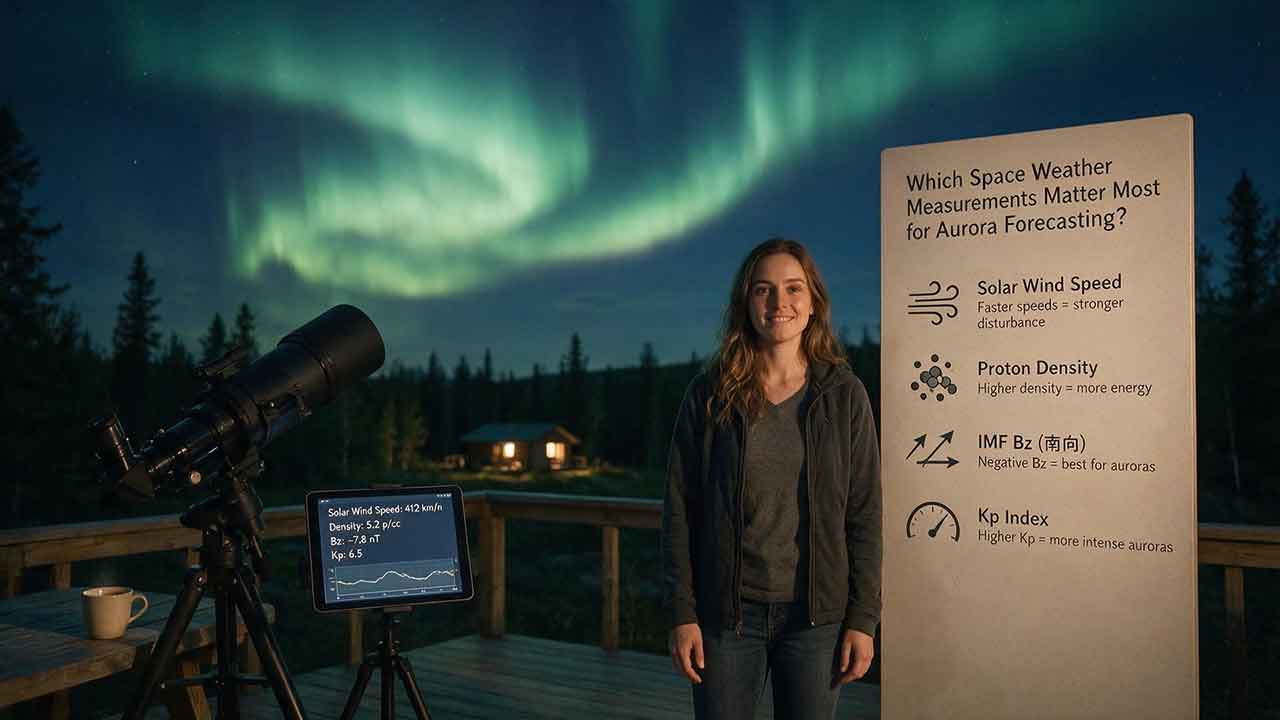
Which Space Weather Measurements Matter Most for Aurora Forecasting?
Aurora forecasting becomes more reliable when each space weather measurement is used for the right decision window. This guide explains why CME direction and propagation models matter several days ahead, while sustained southward Bz, total magnetic-field strength, solar-wind speed, density, and dynamic pressure become more useful as a disturbance approaches Earth. It also shows how Kp, auroral-oval maps, hemispheric power, AE, Dst, and local magnetometers answer different forecasting questions. Readers will learn a practical Signal–Coupling–Response–Visibility framework, compare upstream warning time with NOAA’s auroral-model guidance, work through a dynamic-pressure example, and troubleshoot conflicting forecast signals. The article also explains commonly overvalued indicators, including flare class, isolated Bz spikes, and Kp values without local-time context. Designed for aurora viewers, photographers, and travelers, it provides a clear checklist for combining official space weather data with darkness, cloud cover, road safety, and horizon visibility—without promising that any single measurement can guarantee a visible display.
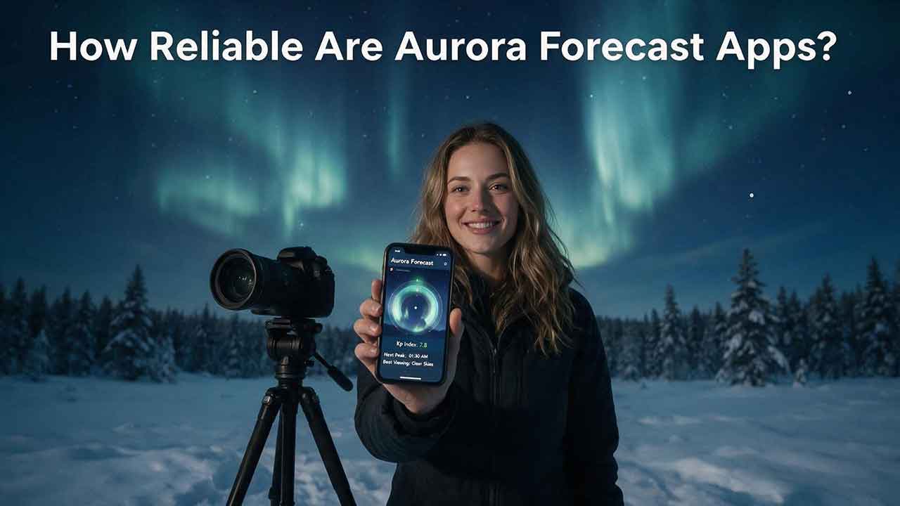
How Reliable Are Aurora Forecast Apps?
Aurora forecast apps are useful for identifying periods of elevated geomagnetic activity, but they cannot guarantee that the northern lights will be visible from a specific location at a specific time. This guide explains why app alerts sometimes disagree, how forecast reliability changes as an event approaches, and which measurements deserve the most attention. Readers will learn how to interpret the auroral oval, observed and forecast Kp, solar-wind speed, Bz, cloud cover, darkness, timestamps, and official space-weather alerts. The article also introduces the Signal-to-Sky Reliability Framework, a viewing-location comparison tool, and a transparent method for auditing app notifications without inventing accuracy claims. Practical tables, troubleshooting guidance, and a step-by-step verification process help casual observers, photographers, travelers, and lower-latitude aurora chasers decide when an alert is worth acting on. The guide is based on authoritative documentation and published research rather than hands-on commercial app rankings.
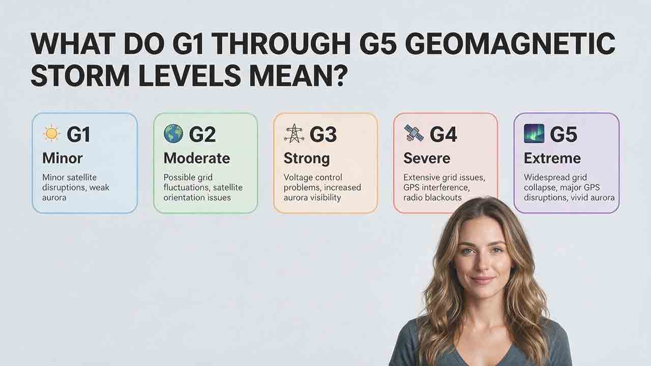
What Do G1 Through G5 Geomagnetic Storm Levels Mean?
NOAA’s G1 through G5 scale ranks geomagnetic storms from minor to extreme and translates planetary Kp measurements into practical impact categories. This guide explains the exact relationship between G levels and Kp notation, including why Kp 9− remains G4 while only Kp 9o qualifies as G5. It compares the possible effects of each level on aurora visibility, power systems, satellites, high-frequency radio, GPS, and precision navigation without treating those outcomes as guaranteed. Readers also learn how to distinguish a forecast, watch, warning, and observed alert; convert UTC forecast windows; interpret decimal Kp values such as 4.67 and 8.67; and apply the Scale–Status–Window–Location–System framework. Practical tables, a G3 watch example, common mistakes, and user-specific recommendations help the public, aurora observers, and technical users respond appropriately without unnecessary alarm.
Explore More Topics
How to Photograph the Northern Lights
Photographing the Northern Lights requires more than choosing one fixed camera setting. This practical guide explains how to select a camera and lens, focus accurately on stars, stabilize your equipment, and adjust shutter speed, aperture, and ISO according to the aurora’s brightness and movement. It includes starting settings for fast, moderate, and faint displays, along with a Motion–Brightness–Foreground framework that helps photographers make better decisions as conditions change. Readers will also learn how to use a smartphone Night mode, compose a stronger foreground, protect color-channel highlights, edit images responsibly, and disclose exposure blends clearly. A quick-reference card, three-frame comparison method, packing checklist, safety guidance, and detailed troubleshooting table make the article useful in the field. The guide relies on published guidance from NASA, NOAA, Nikon, Canon, and Apple while clearly distinguishing authoritative information from adjustable photography recommendations.
How Far South Can the Northern Lights Be Seen?
The northern lights usually remain within high-latitude regions, but powerful geomagnetic storms can carry visible aurora surprisingly far south. This guide explains why there is no single worldwide southern boundary and shows how geomagnetic latitude, the auroral oval, Kp, storm intensity, emission altitude, darkness, cloud cover, and local light pollution affect what an observer may see. It examines NOAA’s generalized U.S. visibility examples for G1 through G5 storms, while clarifying that locations such as Alabama, Florida, and southern Texas represent rare historical possibilities rather than guaranteed forecast limits. Readers will also find an original four-gate decision framework, an auditable geometric viewing-distance example, regional viewing guidance, a practical checklist, and troubleshooting advice for distinguishing faint aurora from clouds or artificial sky glow. The article helps observers decide when a forecast justifies going outside or traveling to a safer, darker viewing site.
What Are the Best Conditions for Seeing the Northern Lights?
The best Northern Lights viewing conditions occur when geomagnetic activity, clear weather, darkness, and a suitable observing location align. This guide explains why the position of the auroral oval matters more than relying on a single Kp value and shows how cloud cover, twilight, light pollution, moonlight, atmospheric transparency, and horizon visibility affect what an observer can see. It introduces the Five-Gate Aurora Viewing Framework, a practical planning tool that evaluates aurora activity, clouds, darkness, location, and available viewing time without presenting the result as a guaranteed probability. Readers will also learn how to compare short- and long-range forecasts, convert UTC forecast periods, choose a safe dark-sky site, recognize faint aurora, and troubleshoot a promising forecast that produces no visible display. The article is based on guidance from NOAA, NASA, the University of Alaska Fairbanks, and the National Park Service.